Transcript
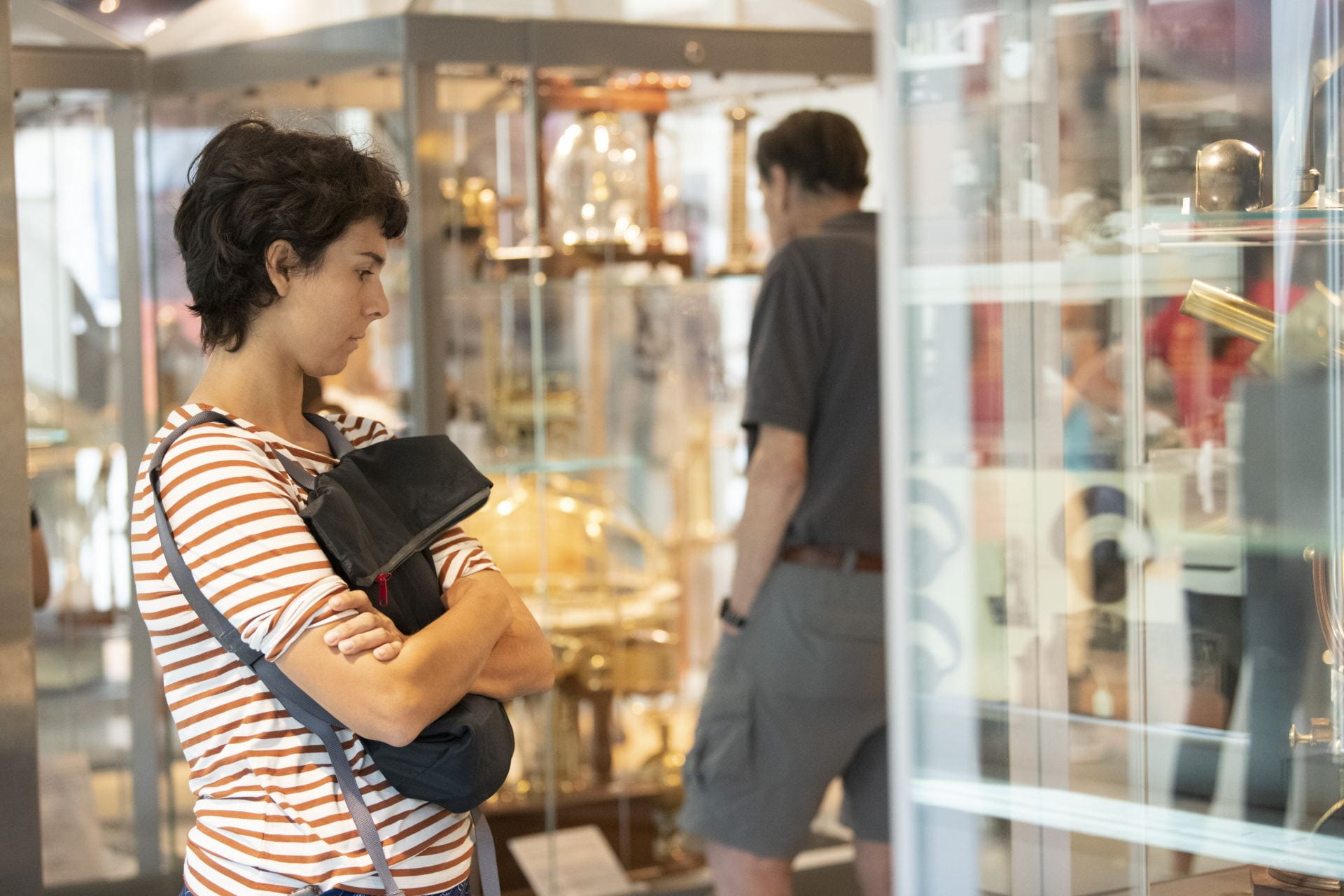
Jennifer Berglund 00:04 Welcome to HMSC Connects! where we go behind the scenes of for Harvard museums to explore the connections between us, our big, beautiful world, and even what lies beyond. My name is Jennifer Berglund, part of the exhibits team here at the Harvard Museums of Science and Culture. And I’ll be your host. For our third episode, this oceans month, I’m speaking with John Huth, an experimental particle physicist at Harvard, and part of the ATLAS experiment, an effort to make new forms of matter by colliding protons together at super high energies. But that’s a topic for another episode, because today I’m talking to him about his other interest–navigation. A few years back, we worked with John on an exhibit called Finding Our Way: An Exploration of Human Navigation at the Collection of Historical Scientific Instruments. I wanted to talk to him today about how he became interested in the topic, and specifically, navigation at sea. Here he is. John Huth, welcome to the show!
John Huth 01:34 Well, it’s a pleasure, Jennie.
Jennifer Berglund 01:40 You have this fascination with early forms of navigation.
John Huth 01:44 Yes.
Jennifer Berglund 01:45 So tell me about that and how you first developed that interest.
John Huth 01:51 2003 in October, it was Columbus Day weekend, and I took out my kayak. It was a bright, sunny day, warm in the air. Noticed the wind direction didn’t have a compass with me, which was stupid, but I did it anyway. So I started paddling, and wouldn’t you know a fog bank rolled in. And by this time I was like, Okay, well, it’s a fog bank. I use the wind. I know which way the shoreline is running and all I had to do is turn north to bump into the shoreline. Paddled back home, took out the kayak, took a shower, went out to the movies, had dinner, nothing remarkable about it. The next day, I went out, and I was paddling again. And the harbormaster stopped me and he said, “have you seen two young women in kayaks?” And I said, “No. What’s going on?” Turned out, the very moment I’d launched my kayak the day before, when it was clear and sunny, there were two young women only half a mile down the beach that were launching two of their kayaks, and they paddled out and got enveloped in the fog just like I had, but they didn’t make it back to shore. Their boyfriends who are waiting for them called the authorities, and unbeknownst to me, overnight, there was a massive search and rescue mission that was going on for them. They found the two kayaks tied together. Then the next day they found the body of one of them, dead floating in the water. Never found the body of the other. Sort of the typical reaction is you read about something like that in the newspaper, and, of course, it’s sad and it’s tragic. But if you’re doing the exact same thing at the exact same time in the exact same conditions, and you lived, and they died, it had a rather profound effect on me. And I suffered from survivor’s guilt. Why them and not me? At first, I didn’t know how to work it off, but then I realized that the one thing that did make the difference was paying attention to the wind direction. And I got obsessed with natural means of navigation. So, wind direction, cloud formations, stars, I memorized the position of the major stars in the sky. After about a year, number one, I realized that I was looking at the world differently so that the Sun was telling me something, the shadows were telling me something, the stars were telling me something, the wind was telling me something, what the wind was doing to the ocean all told me something, and there was this greater awareness of the world around me. I would see other people unaware of these things. And I felt like they were sleepwalkers. I mean, there’s no reason why they should be studying these things, because a year before I was like them, but I almost wanted to sort of shake them out of this stupor. The other thing that I found was that I started to realize, well, wait a second, if I did this, other people must have been doing this in the past. And I started to study how navigation was used in many different cultures– Polynesians, Micronesians, the Norse crossing the North Atlantic. How did people cross the Sahara desert? One thing morphed into another, and it became sort of a second research topic for me.
Jennifer Berglund 05:18 Which tools and techniques do you find most fascinating?
John Huth 05:24 You think about it, we have our bodies. If you peel back the meaning of words, we used our bodies as ways of measuring things. A mile is from Latin, mille passus, which means 1000 paces. And literally, you can use your length of your paces and count them to measure distances as you’re walking. If you look for cardinal directions, they come from natural things, like east in most Indo-European languages means the direction of the rising Sun. South, a lot of times, means Sun, or when the sun is the highest point in the sky, it’s to the south. And west, like occultation, or occult, is where the Sun winks out to the west. There are all these natural environmental things associated with the human body. If you want to navigate at sea, you can use a technique called chasing down latitude. So, you sail north or south until you reach a point where, let’s say, a particular star passes directly overhead over your zenith, and then you turn west, and then you reach your destination because you associate that star at its zenith with a position. So, for example, a person sailing from Tahiti to Hawaii would probably sail north until Arcturus passes directly overhead, which is the same latitude, let’s say, as the southern Big Island of Hawaii, and then you could just sail west into the Hawaiian archipelago at that point. So, it’s the natural things that I found the most interesting, but then, there’s kind of a natural evolution of some of these things into instruments. Arab traders, when they crossed the Gulf of Arabia to India, they would try to keep Polaris at a certain height. And so they would extend their arm and use a certain number of finger- widths above the horizon to calculate their latitude from the height of Polaris. And then that evolved into an instrument called a kamal, which is a piece of wood, a placard, if you like. And it’s held with a string that has knots in it, and you put the knots in your teeth, and you hold out that little placard. And now you get something that’s a bit more precise than just your finger-widths. And these instruments evolved over time. Sometimes the instruments that were used in astrology, were adapted for celestial navigation in the West. There was a device called a sun compass that was used by the Norse in crossing the North Atlantic. I have my students make it, and it’s very precise and fun. It also tells time for you just by using the position of the Sun.
Jennifer Berglund 08:02 How did sailors start navigating using the stars? How did it come about? And how did celestial navigation ultimately make major contributions to scientific understanding?
John Huth 08:15 In the West, there’s this interesting evolution where I think all cultures use stars for orientation at night. And I suspect that the folklore around stars like Orion’s chasing the Pleiades, and Taurus is between Orion and the Pleiades to guard the Pleiades, the Seven Sisters and so on. These mythologies are actually used as mnemonic devices to actually remember what’s going on and orient yourself. So it’s more than just a mythology of populating the sky with imaginary creatures. It’s really some way to remember what’s going on. So, there’s just the orientation and use of the height of the stars in the sky. Associated with that was a belief in astrology which sort of reached in the West kind of an apex and Ptolemy, who developed the system of astrology where you have the zodiacal signs. All the planets move through the signs of the zodiac–Aries, Taurus, Pisces, and so on. And each of the zodiacal signs have a certain character. There’s the Sun sign, that’s when you were born, the Sun was in one of those diagonal signs and it’s supposed to mean something about your character. But moreover, in the West, there’s something called Natal Astrology. And in addition to the zodiacal signs and the celestial objects that inhabit them, there are houses made famous in the song, The Age of Aquarius, when the moon is in the seventh house. Houses sort of gird the sky for the local observer. There are 12 of them, and each of these houses encodes for a certain part of your life. So the idea is at the moment you’re born at the place where you’re born, latitude and longitude, you have to know that, there’s then a fairly unique mapping of the zodiacal signs into the houses, the celestial objects into the houses and the celestial objects into the zodiacal signs. And then an astrologer uses tables, knowing the place of your birth, and the time of your birth to then figure out where all these things are located with an almanac. So somebody has to sit down and calculate where are the positions of the stars and the planets at a given place at a given time. And this was kind of stock and trade of people that would do these lengthy calculations, including a model where the Earth was the center of the universe, and there were these complicated epicycles and all this sort of thing. So that was the state of the art around the mid to late 1400s, and the Portuguese, and most of Europe, were reliant on Arab trade for spices, gold coming across the Sahara, and, well, unfortunately, the legacy of the slave trade. And the Portuguese decided they were going to cut out the middleman and start sailing around the coast of Africa for gold, slaves, and then, eventually to get spices from the Spice Islands. But what happened was that as they get farther south along the coast of Africa, they would lose sight of Polaris. So they needed to have some way of marking effectively the islands and the fortifications that they were creating. The way they did this was a kind of reverse engineering. So remember, if you know the date and place of your birth and time of your birth, you know where the stars are in the sky. So if you take astrologers, you put them on shipboard and you tell them to reverse engineer the process. Here are the stars. Here’s the date. Here’s the time, figure out where you are. Over time, the need for precision in these almanacs became more and more powerful, and there were some discrepancies. Tycho Brahe who was a Danish astronomer, made observations and found that the position of Mars was out by about six degrees periodically, and assigned a protege, Johannes Kepler, to actually figure out what was going on. And after a lot of head scratching and blind alleys, Kepler figured out this idea that planets orbited the sun in ellipses, and there were certain regularities, and this made for a much better Almanac, as it turns out, more precise. And then there was speculation that there was a certain law called the Inverse Square Law that was responsible for gravity, and Newton picked this up as a topic to study during the plague years in London when he escaped to Cambridge. And that’s where physics was born from. So there was a strange lineage that went from astrology to navigation to a search for a precise almanac, to the laws of physics. So maybe we aren’t that far away after all.
Jennifer Berglund 12:56 When you set out on this navigation journey, I guess that’s a weird way to say this, but this, this exploration of navigation, I suppose, did you know that all roads would lead back to physics?
John Huth 13:10 No, I didn’t. But I also kind of wonder if it’s the sort of mindset that maybe Polynesian navigators and Micronesian navigators are kind of physicists in their own right because it’s a kind of mindset, right?
Jennifer Berglund 13:24 Yeah, I guess that makes sense. I’m glad you brought that up, because you also worked on a project in the Marshall Islands.
John Huth 13:32 Yes.
Jennifer Berglund 13:32 Where you were applying scientific concepts to a traditional form of navigation called wave piloting. Can you tell me about that and what you discovered?
John Huth 13:41 The Marshall Islands are a cluster of violence in the Central Pacific, and they seem to have a fairly unique navigational culture where they use waves, and the way waves and swells interact with the atolls and islands in the cluster. And the navigators use these to find their way, primarily, because at nighttime, you’d have clouds in the sky during the daytime, maybe you have clouds, but the waves are always there. So it’s something that you can use. And it was a bit of the mystery when the West first encountered it, first of all, was very secretive, because there was a closely guarded power that the Chiefs had when they conferred the name of ri meto, which is navigator in Marshallese, and they weren’t supposed to divulge the secrets because it was indeed a kind of power. At a certain point, the navigators asked the Chief to explain to Westerners what the system was. And they communicate also this knowledge to apprentices using something called stick charts, which are sticks that are tied together in various patterns, and they’re used as ways of teaching the patterns of how waves operate. So I met an anthropologist named Joe Genz, who did his dissertation on navigation in the Marshall Islands, and he worked with a traditional navigator named Captain Korent. And Captain Korent was interested in seeing the traditional means not only get furtherd, whereas they were in danger of dying out, but also seeking a scientific validation of them as a way of basically saying, yes, our culture is valid, we found real things. So, that’s where I got engaged, and another investigator, Gerbrant van Vledder, who specializes in numerical simulations of waves. So we went to the Marshall Islands, and did a voyage with an outrigger canoe in a chase vessel between two atolls using non-instrument means. And I had the job of being sort of the recording secretary, so I had to cheat and use a GPS unit to figure out where we were. We didn’t communicate that to the navigator in the outrigger canoe, of course, but then measured windspeed, measured the wave conditions. We voyaged to this remote atoll, spent several days there, then we sailed back. And what was interesting to me was the navigators, they say that they have to feel the motion of the boat. They lie on their back and they feel how the boat moves, and they don’t trust their eyes. It’s not what you see, it’s what you feel is the motion of the boat. And I did this on the voyage back. I closed my eyes and lay down, and I could feel the trade winds. Trade wind waves were basically pushing me one way in the vessel, and then, every so often I would feel a swell from the North Pacific coming through. So I was starting to get attuned to this. I also found that most of the information that’s important is carried in waves that are long periods. So very short, choppy waves don’t carry much information, but long swells do. What I believe the reason they lie in the back in the vessel is this averages out all that sort wavelength stuff, and now the long wavelength stuff is what really communicates information to you. And then there are other characteristics of waves like how they spread out and angle, which gives a fairly regular pattern, and learned about the voyaging patterns between the atolls, which are kind of oriented north-south, and so the way the trade winds interact with these islands on these north-south chains, sets up kind of a regular system that allows people to navigate between the islands. So I think I started to peel back some of these mysteries. Anthropologists could record what people said, but then kind of turning it into something that actually has this physical explanation was kind of the added step that we made.
Jennifer Berglund 17:44 These days, our navigation systems are readily available to us on our phones, with GPS and so on. Many of the early tools and techniques for navigation that you’ve been talking about are considered obsolete. I know you don’t agree with that. Why do you think it’s important that we preserve this knowledge?
John Huth 18:05 Well, multiple answers. There’s kind of the superficial answer that GPS might fail under certain circumstances, like you can get weak signals, your cell phone falls into the ocean. Another issue is that these GPS is only as good as the databases that you use, unless you use complete latitude and longitude systems. So, things could get mislabeled. If I go to Google and I type in the phrase, “your GPS is wrong”, you’ll get a page full of images of signs that people put up because locations were improperly noted in databases and that sort of thing. And then there’s a very weak signal to background of GPS, and so they are prone to failure from time to time. So there is just that practical issue. There is a deeper issue though, which is that the part of the brain that is used for navigation, mostly the hippocampus, that part of the brain is also responsible for declarative memory. So if I were to ask you the name of your favorite high school teacher, as an active will, you can go and retrieve the name of that high school teacher. Okay, that’s declarative memory. That’s also in the hippocampus. Future Planning is also associated with the hippocampus, and that’s why the language of navigation is associated with how people lead their lives. So you kind of made the slip of saying, you know, how did you get on this journey of navigation and stopped yourself, but the fact is, it’s not accidental because we use that language of navigation to tell you how people lead their lives. It’s, it’s it’s no accident. So, if you dig even deeper, there is just a ton of spatial modifiers that are used for social interactions. So we say, status is associated with height, for example. So let me go talk to my higher ups and that sort of thing. So if you start to peel back the layers of conversation, you’ll find that it’s almost impossible to not invoke navigation in either kind of a future planning sense or in a social sense. So one of the things that I fear is that if we degrade our native sense of navigation, we may be degrading other parts of our ways of thinking. And so, getting back and reusing that part of our brain that was wired for that purpose and has these other kind of offshoots that touch it may be very important for our own mental well being. So that’s kind of the deeper pitch I would give for not getting addicted to GPS. I’m not saying, don’t go without it in case you need it, but maybe try to stay away from it as much as you can, let’s say.
Jennifer Berglund 20:48 How has your interest in navigation changed you in your everyday life?
John Huth 20:54 I don’t know. It’s sort of given me this endless puzzle out there. I mean, it’s always kind of presented me with this puzzle that that I’m always trying to solve because every place is a little bit different. You know, the winds going to be different any given day and so on. So it’s this nice awareness that kind of takes me away from, I don’t know, the more mundane sameness of continually being in Zoom meetings or something.
Jennifer Berglund 21:19 And I would think that it would just make you more observant of your environment, and I feel like, as humans, we have sort of this innate desire to connect with our natural world. So, I don’t know if there’s a little bit of that too.
John Huth 21:33 Yeah, I think so. It’s humanizing and a lot of ways because we did grow up in a much more natural setting, and we had to rely on these things. And I think it kind of gets you back to the way our brains evolved. And it seems like a very healthy thing to do. There’s a certain richness of the human condition that gets exposed when you start to think about these things. How does a bird sense the Earth’s magnetic field? That’s an interesting problem that molecularly hasn’t been solved. Or how did people think about the world before they realized that it was round? And how did they figure out it was round? And then go back and read the Iliad for example, and see how people thought then, and try to put yourself in the mindset of humans with different timeframes. It just has all these little tendrils and branches and you start to pull on them and it just is very rich for me.
Jennifer Berglund 22:28 It’s kind of a form of mapping in your brain, you must have a very healthy hippocampus.
John Huth 22:34 It could be could be. Sometimes it doesn’t. Maybe gets overactive.
Jennifer Berglund 22:41 I don’t think there’s anything wrong with that. Don’t stop, never stop. John Huth, thank you so much for being here today. I could talk to you all day learning about this stuff.
John Huth 22:52 My pleasure.
Jennifer Berglund 22:58 Today’s HMSC Connects! Podcast was produced by me, Jennifer Berglund, and the Harvard Museums of Science and Culture. Special thanks to John Huth and the Harvard Physics Department. And thank YOU so much for listening! If you liked today’s podcast, please subscribe on Apple podcasts, Spotify, Podbean, or wherever you get your podcasts. See you next week!
Transcribed by https://otter.ai